
Grade
HillyDistance
108 kmCycling
1 - 2 daysAbout the trail
Tiniroto Trail is a new connector ride recently added to the group of Ngā Haerenga New Zealand Cycle Trail "heartland trails".
This rural adventure cycle ride climbs to a maximum altitude of 434m, and connects Gisborne and the Rere Falls Trail to Te Wairoa and Hawke's Bay with a ride of more than 100km.
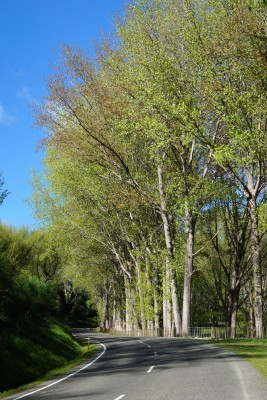
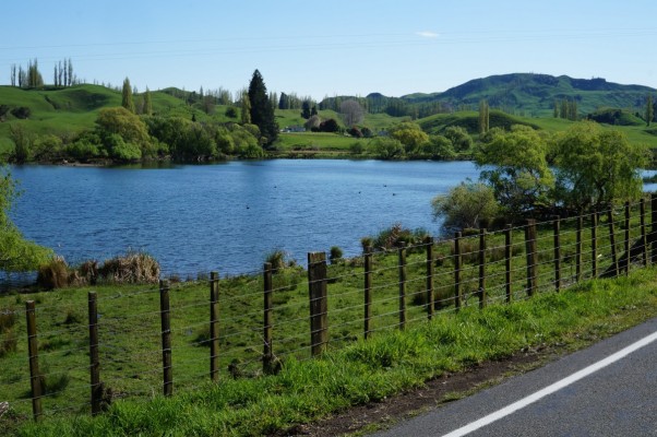
From Gisborne, at the Pātūtahi side of Gentle Annie Hill, Tiniroto Road wraps around Gentle Annie Reserve, in the upper catchment of Te Aroha Stream. The reserve includes a hill slope of native bush. A small picnic area under big old gum trees has long since been abandoned and left unmaintained. The Farm Forestry Assn planted many trees in the reserve as an Arbor Day project in the 1980s. Now-mature liquidambar and red oak trees lining the roadside brighten autumn days as do cherry trees along the roadside in spring. The Gentle Annie Summit, elevation 360m, offers panoramic views of Tūranganui a Kiwa and Gisborne.
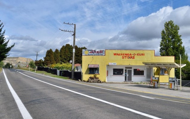
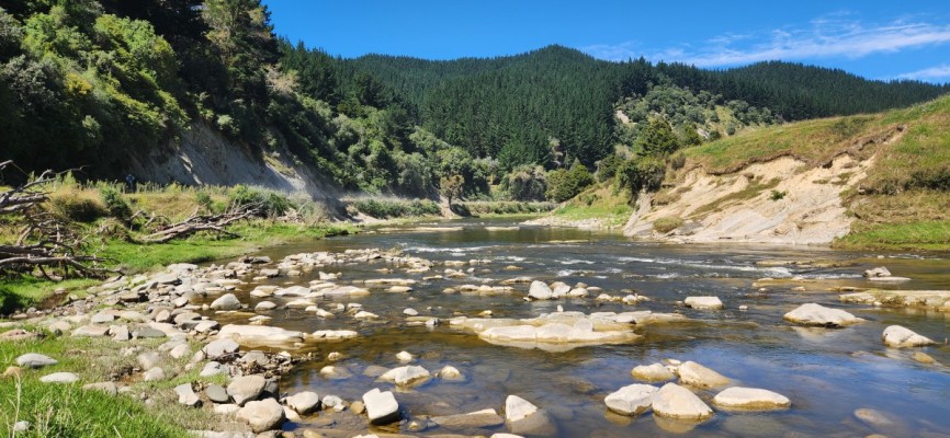
You will cycle through the small settlements of Waerenga-o-Kurī and Tiniroto on Tiniroto Road. However, it is advised to carry enough food for your cycle tour because both the Waerenga-o-Kurī store and the Tiniroto Tavern are closed. Doneraille Park, a popular picnicking, camping, swimming and fishing area on the Hangaroa River has been closed to the public since Cyclone Gabrielle when the Ruakaka Road bridge over the river was destroyed. The rebuild of this bridge has begun and it is expected that the new bridge will be opened at the end of 2026. As you cycle beside the Hangaroa River you will find a choice of quiet picnic spots and there is excellent trout fishing in the river. Another attraction is the Hackfalls Arboretum on Berry Road, a side road off Ruakaka Road, Tiniroto.
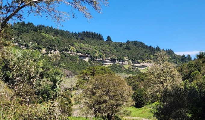
At Te Rēinga, 10km south of Tiniroto, the Hangaroa River joins the Ruakituri River, and together become the Wairoa River. Where the rivers join, the Wairoa River drops in a spectacular waterfall, Te Rēinga Falls. To view the top, where the water tumbles over the falls, follow a 5-minute walking track from the carpark just across the Te Rēinga bridge. The adventurous can follow a rough scrambling path from the lookout to near the bottom of the waterfall. Take care, the rocks on the way down can be slippery.
Options for home stay accommodation along the route, or nearby, include -
- Hackfalls Arboretum farmstay cottage, Hackfalls Arboretum accommodation Kirsty Playle offers cooked meals if requested in advance.
- Taaheke Farmstay, 460 Pehiri Road, Pehiri. Phone Johnny and Pip Williams 027 778 5844, Taaheke Farmstay
- Mahaanui Farmstay Experience, located along Ruakaka Road, offers three private, unique accommodation options.
- A little further off the cycle trail, Ruakituri Cabin is situated beside the Ruakituri River. Turn off Tiniroto Road on to Ruakituri Road at Te Rēinga and travel 20km to the Papuni Road turn off. Then, follow Papuni Road for a further 6km, to reach Ngapakira Road and Ruakituri Cabin.
More basic accommodation is available at the Tiniroto Hall. Contact Kirsty Playle - playle@xtra.co.nz, 06 8637083.
The cycle trail continues along Tiniroto Road, following the Wairoa River, passes Whakapūnake Maunga, and takes you to Frasertown (Te Kapu), then continues along Frasertown Road to Te Wairoa. Frasertown was established as a military settlement in the 1860s. It has an historic cemetery, a tavern, store and takeaways.
The attractive town of Te Wairoa straddles the Wairoa River and has a rich culture and heritage, which is shared with visitors through the Wairoa i-site. Te Wairoa in Māori means 'the long water'.


History of the trail
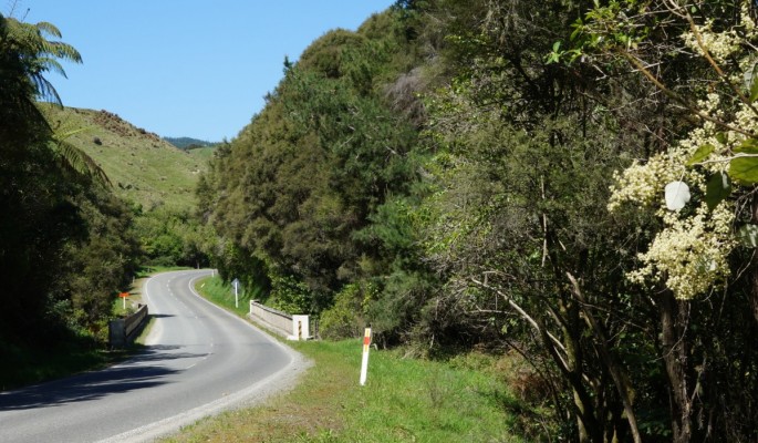
Forging a coach road between Gisborne and Te Wairoa was challenging for the settlers in the late 1880s. In 1901, Parikanapa Road connected Gisborne to Te Wairoa but the road over Parikanapa mountain was so steep and tortuous that calls were made to abandon this as a main road. The alternative, following what seemed like the natural route, was planned to be via Hangaroa. Although the Hangaroa River Bluffs section presented a major obstacle, this became the main road from Gisborne to Te Wairoa via Tiniroto. The Gisborne to Te Wairoa road via Morere also presented many challenges but was used by coach traffic from the early 1900s.
Before Waerenga-o-Kurī became a European settlement, it was a traditional meeting place for the coastal and inland hapū (sub-tribes). It was a trading place for food like crayfish, fish, paua, kūmara, eels, kererū (native pigeons), weka and mutton birds, since there was plentiful food here. Living Heritage, Waerengaokurī School
Waerenga-o-Kurī was established as a farming settlement in the late 1800s. The first hotel was built in 1887; the first school, 1879. The first Waerenga-o-Kurī hall was built in the Hangaroa district in 1913. It was moved to the Waerenga-o-Kurī district in 1927. In 1901, Waerenga-o-Kurī had a post and telegraph office and was noted as a health resort, owing to its elevation at 344m.
Tiniroto is the other small settlement on Tiniroto Road. The first settlers came to Tiniroto in 1868 when the land was covered with bush. The name Tiniroto was coined by surveyor and ethnologist Stephenson Percy Smith in response to the many lakes in the vicinity that originate from landslides thousands of years ago, but the name contravenes the rule of Māori grammar, which normally places the adjective (in this case tini:many) after the noun (roto:lake). The largest lake lies close to the village.
At Te Rēinga, the story is told of Hine-kōrako, a female taniwha who married a local man. After being insulted by his people, she went to live under Te Rēinga Falls. One day, when the Wairoa River was in flood, a canoe carrying local people was being swept towards the falls. In desperation a kaumātua (elder) called out to her, and she rescued those on board. (From Te Ara, The Encyclopeadia of New Zealand.)
Tips & Logistics
This Ngā Haerenga NZ Cycle Heartland Trail connects with the Rere Falls Trail. Begin cycling along the Waipaoa River Coastal Trail section of the Rere Falls Trail, as you leave from Gisborne, then after crossing the Matawhero bridge over Waipaoa River, take the second exit from the roundabout, which is Tiniroto Road.
Tiniroto Road is considered an alternative route to State Highway 2 (Wharerata Road). A major project to make this road resilient is expected to be completed within three to five years. Rock scaling to remove overhanging rock outcrops and reduce rock fall risk was completed in 2024. However, the road is still vulnerable to weather events and Gisborne District Council may close the road at short notice when high rainfall is predicted. If Tiniroto Road is closed at the Hangaroa Bluffs, an alternative cycling route is to use Parikanapa Road, a gravel road which follows high ridges and offers spectacular views.