
Grade
EasyDistance
16kmWalking
4 hoursCycling
1 hoursAbout the trail
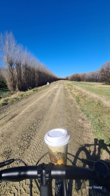
The Coastal Waipaoa River Trail is the Gisborne (Tūranganui a Kiwa) end of the Rere Falls Trail, one of the Ngā Haerenga NZ Cycle Trail heartland rides. It consists of a trail following the top of the Waipaoa River stop bank along with a ride on the road on Centennial Marine Drive. The stop bank trail provides expansive river mouth views to the south, and to surrounding hills, farms and agricultural production areas to the north and northeast.
This can be a "there and back" trail ride from Gisborne to Matawhero. An alternative is to cycle a loop ride by incorporating a rural back road route, a ride of 32 km. The route described below is one of the route options from Wharekopae Road to Gisborne when completing the Rere Falls Trail.
To create a loop ride, from the Matawhero Waipaoa River bridge, or from Riverpoint Road, cross Wharerata Road State Highway 2 with care to join Bloomfield Road, a left turn. After 2km, turn right into Bushmere Road, then left into Farmer Road. Cross Makaraka Road State Highway 2 with care and continue on Pilmer Road, turning right into Tucker Road, then right again into Nelson Road. Nelson Road will take you into Gisborne, and back to your starting point. Coastal Waipaoa River Trail Leaflet


Trail fly-through
History of the trail
The stop banks are part of the Waipaoa Flood Control Scheme, designed in 1949. The scheme took 25 years from initial planning until it was declared complete in 1973. This dramatically changed land use on the Gisborne Flats -- from sheep, maize and pumpkins to a mix of vineyards and food crops with multi-million-dollar earning capacity – and protected homes and livelihoods across 9,900ha.
The Māori name of the river is associated with Wai-o-Pāoa, the river of Pāoa. The great chief Pāoa lived with his people in the forest of the mountainous interior of the East Coast district.
For more in-depth mātauranga Māori, see The Waipaoa River - Turanganui
Tips & Logistics
The trail is exposed to the wind from either the northwest or south. Check wind direction for choice of starting point if you plan to walk in one direction. In a southerly wind, head to Matawhero from the mouth of the Waipaoa River, at the end of Centennial Marine Drive, or in a nor-wester, start at the parking bay at the end of Riverpoint Rd, Matawhero. For a one-way journey, a car can be left at either end of the trail. Note that horse riding is not allowed on this trail. Matawhero Wines is at the north end of the trail, see matawhero.co.nz
The Rere Falls Trail continues towards the Bay of Plenty, following Wharekopae Road, from the north end of this section. By linking Rere Falls Trail with the Motu Road Trail, you can create a stunning 180 km 'Coast to Coast' ride from Gisborne to Ōpōtiki. Rere Falls Trail - Cycling trails
We acknowledge the work of Motu Trails Charitable Trust and Gisborne District Council in creating this trail on top of the upgraded stop bank.