Grade
Tramping track, steep in placesDistance
9.5km each wayWalking
5 hours each wayAbout the trail
The Lake Waikaremoana Great Walk is a back-country, off the beaten track, hiking experience. The full "around the lake" hike is a multi-day adventure, but three options for a shorter overnight hike are to Waiharuru Hut, to Panekire Hut, and to Sandy Bay Hut. Hut bookings can be made, and hut fees paid, through this website, where you will also find information about other day walks nearby. Department of Conservation Lake Waikaremoana Great Walk
Te Urewera, a stunning natural wilderness enclosing lakes Waikaremoana and Waikareiti, is the homeland of Ngāi Tūhoe. At Te Wharehou o Waikaremoana at Aniwaniwa you can learn about Ngāi Tūhoe and the significance of Te Urewera to the tāngata whenua (the people of the land). New information panels at each of the huts around Lake Waikaremoana offer further information - about the name of each hut and significant events that occurred in the local area. As well, the key purposes of Te Urewera Act are stated, including to strengthen the connection between Ngāi Tūhoe and Te Urewera, and to preserve the natural ecosystems - work that is being carried out by the mana whenua (local people) through pest control.
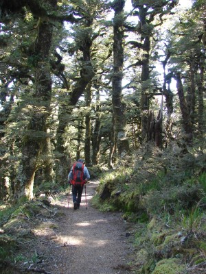
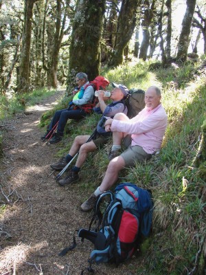
After parking your car at Onepoto, pause at the shelter at the start of the climb up the Panekire Range to read the information about some of the history and the natural environment. You will find much of the climb is on an easy gradient but there are steep sections.
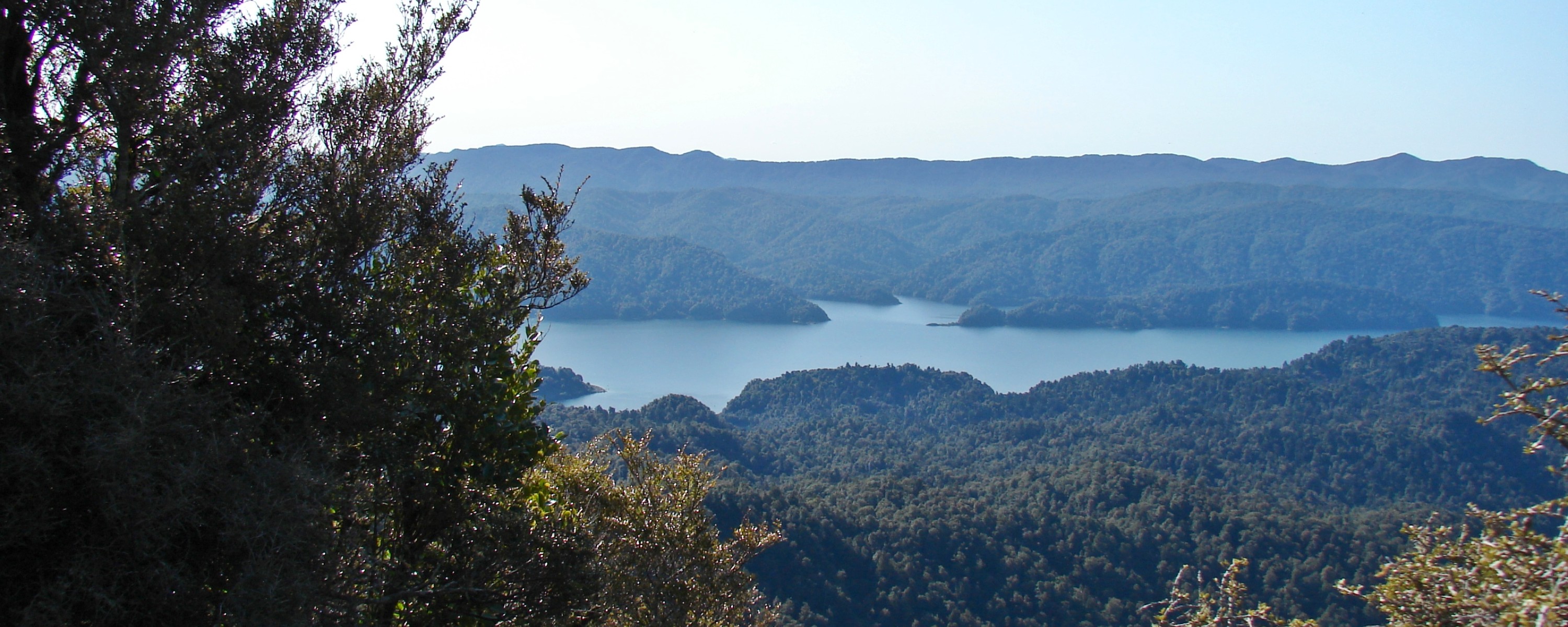
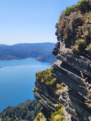
Trig A61J, which you reach after gaining 380m and after an hour or so of climbing, is an excellent rest stop with views over Lake Waikaremoana from the top of a rocky bluff. Panekire Bluff, after a further 1.5km of climbing is also a dramatic lookout.
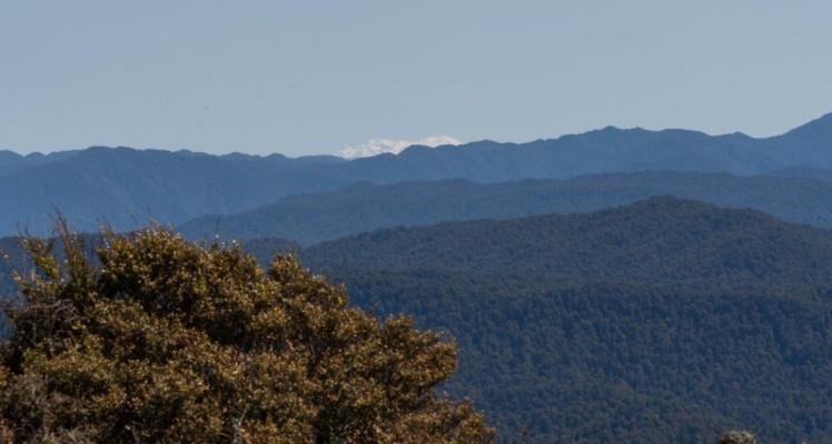
Keep an eye out for the side track on the right to Bald Knob about two thirds of the way to Panekire Hut. Drop your pack on the track and follow this short diversion for stunning views to the west and south-west. On a clear day you may see Ruapehu and Ngauruhoe, roughly 190km away, over Te Urewera and Whirinaki ranges.
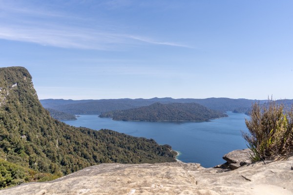
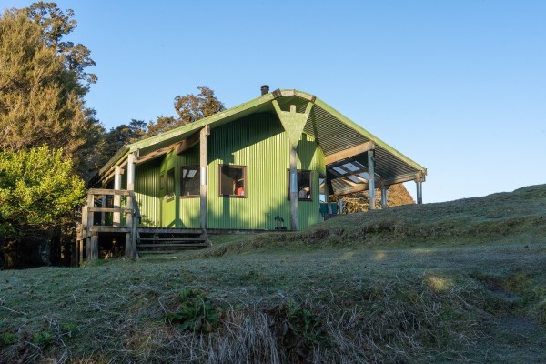
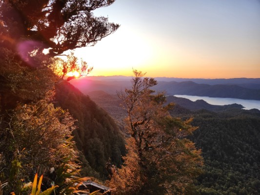
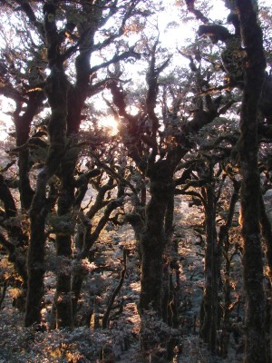
Panekire Hut (1180m) is situated in a clearing overlooking a bluff at the southwestern most high point along the Panekire Range -- a dramatic spot beside Puketapu Trig.
Camping is not available near Panekire Hut. If you arrive in rain, there is plenty of room to hang up dripping jackets and wet clothes under the verandah. A sunset walk for photography can yield spectacular results, with the best opportunity to see the setting sun being from the wooden steps just north of the hut, on the other side of Puketapu Trig. Snow often blankets the ground in the winter months, and clear nights and early mornings may be frosty. With no city lights anywhere near, on a fine night with no moon you will amazed by the starry night sky!
History of the trail
Lake Waikaremoana was formed 2200 years ago by a huge landslide, which blocked a narrow gorge along the Waikaretaheke River. Water backed up behind this landslide to form a lake up to 248m deep. In 1946 a hydroelectric development lowered the lake level by 5m. Lake Waikareiti was also formed by a landslide, a much older one. Te Urewera describes the large forested mountainous area surrounding and to the north of these lakes.
Te Urewera was the first natural feature to be recognised in New Zealand law as a legal entity in its own right. The Te Urewera Act 2014 established that Te Urewera is no longer Crown land and ceased to be a national park. Te Urewera Act 2014 The purpose of this Act is to establish and preserve in perpetuity a legal identity and protected status for Te Urewera for its intrinsic worth, its distinctive natural and cultural values, the integrity of those values, and for its national importance, and in particular to:
- strengthen and maintain the connections between Tūhoe and Te Urewera
- preserve as far as possible the natural features and beauty of Te Urewera, the integrity of its indigenous ecological systems and biodiversity, and its historical and cultural heritage
- provide for Te Urewera as a place for public use and enjoyment, for recreation, learning and spiritual reflection, and as an inspiration for all.
Tips & Logistics
The carpark at Onepoto (the start of the walk to Panekire Hut) has a toilet and shelter with information panels.
Find out everything you need to plan for this track on Plan My Walk